“Navionics Maps Navionics + empty SD /Micro SD XL9 nautical chart” has been added to your cart.
View cart -
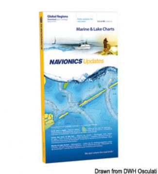
Display real-time position direction speed and track. Bathymetrics navigation aids with Xplain � technology port services (gas stations mooring shipyards etc. With phone numbers where available) tides and currents.Verify that the instrument is capable of reading MSD-SD memory media greater than 2 GB in capacity.
-
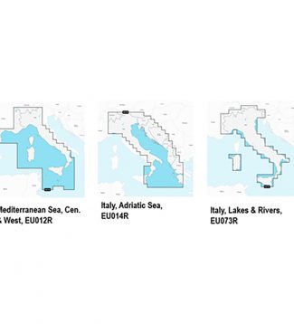
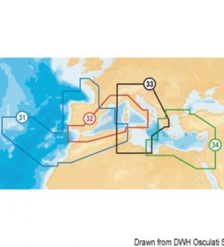
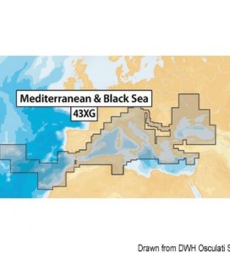
Essential details including the port plans bathymetry list of phone numbers and much more. Hundreds of thousands of changes by theNavionics Community viewable on some GPS plotter compatible with Freshest Data. Access to any cartographic layers in the region purchasedSonarChart � the bathymetric map HD Navionics that reflects the ever-changing bottom conditions. Auto-routing SD /…
-
290,00 €
Navionics Platinum:multi-dimensional Navionics mapping with 3D visualisation – satellite and aerial pictures – panoramic harbour pictures – harbour services and points of interest – dynamic tide iconsNavionics Gold:exceptional detail – bathymetric lines – harbour plans – currents and tides – services – excellent coverage. Navionics +: exceptional detail – bathymetric lines – SonarChart™ – Auto-routing…
-
190,00 €
Navionics Platinum:multi-dimensional Navionics mapping with 3D visualisation – satellite and aerial pictures – panoramic harbour pictures – harbour services and points of interest – dynamic tide iconsNavionics Gold:exceptional detail – bathymetric lines – harbour plans – currents and tides – services – excellent coverage. Navionics +: exceptional detail – bathymetric lines – SonarChart™ – Auto-routing…
-
360,00 €
Navionics Platinum:multi-dimensional Navionics mapping with 3D visualisation – satellite and aerial pictures – panoramic harbour pictures – harbour services and points of interest – dynamic tide iconsNavionics Gold:exceptional detail – bathymetric lines – harbour plans – currents and tides – services – excellent coverage. Navionics +: exceptional detail – bathymetric lines – SonarChart™ – Auto-routing…
-
430,00 €
Navionics Platinum:multi-dimensional Navionics mapping with 3D visualisation – satellite and aerial pictures – panoramic harbour pictures – harbour services and points of interest – dynamic tide iconsNavionics Gold:exceptional detail – bathymetric lines – harbour plans – currents and tides – services – excellent coverage. Navionics +: exceptional detail – bathymetric lines – SonarChart™ – Auto-routing…
-
290,00 €
Navionics Platinum:multi-dimensional Navionics mapping with 3D visualisation – satellite and aerial pictures – panoramic harbour pictures – harbour services and points of interest – dynamic tide iconsNavionics Gold:exceptional detail – bathymetric lines – harbour plans – currents and tides – services – excellent coverage. Navionics +: exceptional detail – bathymetric lines – SonarChart™ – Auto-routing…
-
150,00 €
It is the most convenient product devoted to continuously enhancing your old cartography and getting the most up-to-date Navionics+ (one-year update program included). This online upgrade service to Navionics+ is compatible with Navionics (Gold or Silver but not Platinum+) as well as cards from other brands such as C-MAP, Fishing Hot Spots, Garmin, LakeMaster, Lowrance,…